
The Amazing Race Canada Season 12 Locations: Where They Went and How to Visit
Some places are already on your travel radar. Others sneak up on you because a TV show suddenly makes them look a lot more interesting than they did sitting quietly on Google Maps.
That’s why I like tracking The Amazing Race Canada locations. The show races through places quickly, obviously, but it also gives you a quick glimpse of destinations you might want to visit at a much more reasonable pace.
Season 12 starts in Whistler, BC, one of Canada’s most recognizable mountain destinations and a place I know well. I’ve visited Whistler dozens of times over the years, including when I worked for Whistler Blackcomb, so this opening stop feels like familiar territory – gondolas, village walks, alpine views, and all.
This post tracks the Season 12 filming locations as they air, with practical travel ideas for each stop. I’ll update it weekly as new episodes come out, starting with Episode 1.
You can see The Amazing Race Canada Season 11 Locations here.

Episode 1: Express Pass Let’s Go
Season 12 opened in Whistler, with teams starting the race atop Whistler Mountain. It’s a dramatic place to begin, but also a very visitable one – no clue card, panic-running, or reality TV producer required.
📍Whistler Mountain / Whistler Blackcomb – Whistler, BC
The race began atop Whistler Mountain, part of Whistler Blackcomb.
This is one of the biggest draws in Whistler, whether you’re visiting for skiing, sightseeing, hiking, or the PEAK 2 PEAK Gondola. You don’t need to be a skier to enjoy the mountain either, which is good news for anyone whose idea of a strong travel day involves scenery, snacks, and not falling down a hill.
What you can do there:
- Ride the Whistler Village Gondola
- Take the PEAK 2 PEAK Gondola between Whistler and Blackcomb
- Go skiing or snowboarding in winter
- Visit for alpine sightseeing in summer
- Add a short walk or viewpoint stop if conditions allow
Local tip: Check lift and sightseeing hours before you go. Whistler Mountain access changes by season, weather, and maintenance schedules.

📍Whistler Village & the Whistler Village Gondola – Whistler, BC
After the snow dig, teams rode the gondola down from the top of the mountain into Whistler Village, which is where the first Detour played out.
The village is the heart of Whistler and, happily, the easiest part to enjoy at a non-racing pace. It’s pedestrian-only, packed with cafés, patios, and shops, and it’s where the show set up its “Sparkle or Shine” Detour – stringing twinkle lights onto the big Whistler sign, or learning an après-ski dance at the Longhorn Saloon.
What you can do there:
- Ride the Whistler Village Gondola for the views and hiking trails
- Wander the pedestrian Village Stroll
- Grab a patio table at the Longhorn Saloon, a Whistler institution at the base of the mountain
Local tip: The village is free to walk around, so even a gondola-free day here is worth it. Après-ski energy is real, and no one will make you perform the dance.
📍Whistler Sailing Club & Alta Lake – Whistler, BC
From the village, teams taxied to the Whistler Sailing Club on Alta Lake, where they got a video message and then had to sail out to buoys to collect a few Moana-themed items – a coconut, a conch shell, and an oar.
Alta Lake is one of Whistler’s prettiest and most swimmable lakes, with calm water, mountain backdrops, and a much slower pace than the mountain itself. You don’t need to sail competitively to enjoy it, which is good news for those of us who prefer floating to racing.
What you can do there:
- Rent a kayak, canoe, paddleboard, or sailboat through the sailing club
- Swim or picnic at Lakeside Park or Rainbow Park
- Walk or bike the Valley Trail that connects the lakes
- Just sit by the water and do very little, which is underrated
Local tip: Rainbow Park on the far side of Alta Lake has some of the best mountain-and-water views in Whistler, and it’s a lovely spot for a relaxed afternoon. My favourite is Green Lake for quiet picnicking.

📍The Roadblock: Slackline at Squamish Canyon
For the Roadblock, teams drove the Sea to Sky Highway down to Squamish, where one person had to walk a slackline high above a river to grab the next clue.
Squamish is a great stop in its own right, and if you’re curious about the canyon that’s been mentioned, Squamish Canyon is a real, visitable eco-attraction – a network of elevated boardwalks (around 1.5 km) winding through coastal rainforest with views of Mamquam Falls, about 15 minutes from downtown Squamish.
What you can do in and around Squamish:
- Walk the elevated boardwalks and canyon walkways above the Mamquam River
- Take in the Mamquam Falls viewpoints along the route
- Give yourself about 45 to 90 minutes for the full loop
- Pair it with other Squamish stops like the Sea to Sky Gondola
Local tip: If you do visit Squamish Canyon itself, buy tickets ahead and check seasonal hours, since it’s a newer attraction with timed entry rather than a free trail.
📍The Pit Stop: Squamish, BC
Leg 1 wrapped at a Pit Stop in Squamish, where superfan twins Tina & Liz checked in first. It was a non-elimination leg, so every team lived to race another day. The mat was set up on a soccer field at the Capilano University Squamish campus.
This one’s more of a “that’s where the mat was” stop than a tourist destination, but it’s a reminder of how walkable and compact Squamish is. If you’re building a trip, Squamish itself is the real draw here – it sits right between Vancouver and Whistler on the Sea to Sky Highway.
What you can do nearby:
- Ride the Sea to Sky Gondola for viewing platforms and a suspension bridge
- Chase waterfalls at Shannon Falls Provincial Park
- Watch kiteboarders at the Squamish Spit
- Use Squamish as a relaxed base between Vancouver and Whistler
Local tip: Squamish is an easy, scenic stop on the drive up from Vancouver, so it’s worth building in half a day rather than blowing past it on the way to Whistler.
🧭 How to Visit These Places
If you’re planning a Whistler-inspired trip, don’t try to race through it.
Whistler works best when you give yourself time for the mountain, the village, and one or two quieter stops nearby. I’ve been there dozens of times, and the trips that feel best are never the ones where every hour is booked like a tiny vacation spreadsheet with hiking shoes.
Suggested route:
- Start with Whistler Mountain or PEAK 2 PEAK
- Walk through Whistler Village
- Add Lost Lake, the Audain Art Museum, or the Squamish Lil’wat Cultural Centre
- Stay overnight if you can, especially if you’re driving from Vancouver
- Keep the Sea to Sky Highway portion flexible so you can stop safely for views
- Add Alta Lake for a swim, paddle, or lakeside break
- Stop at Squamish Canyon on the Sea to Sky Highway between Vancouver and Whistler
Best time to go:
- Summer for alpine sightseeing, lakes, and longer daylight
- Fall for fewer crowds and cooler walking weather
- Winter for skiing, snow, and classic Whistler village energy
- Spring for a quieter shoulder-season trip, depending on what’s open
Episode 2: “Is This Your Poo?” – Vancouver → Kelowna, BC
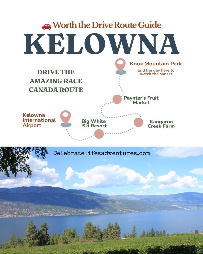
Follow the route: Vancouver → ✈️ Kelowna → Big White Ski Resort → Kangaroo Creek Farm → Paynter’s Fruit Market → The KF Centre for Excellence → Knox Mountain Park
✈️ Getting There
Fly into Kelowna International Airport (YLW) and rent a car for the best flexibility. Most of this week’s locations are spread across Kelowna, West Kelowna and Big White Ski Resort, so having your own vehicle makes it much easier to see everything at your own pace.

Prefer to make your own schedule? Compare rental car prices here.
I’ve lost count of how many times I’ve been to Kelowna over the years, and I’m heading back again this September. It was fun seeing a few familiar places on this week’s Amazing Race Canada, but like most TV shows, it only scratches the surface of what you can actually do while you’re there.
Most people think of Kelowna as wine country—and yes, there are plenty of vineyards—but this episode showed a different side of the Okanagan. From mountain adventures to fruit farms and one of BC’s most unusual animal attractions, these are all places you can easily add to your own road trip.
📍Big White Ski Resort
If you only know Big White as a winter ski destination, this episode is a reminder that it’s worth visiting long after the snow melts. In summer, the mountain transforms into a playground of hiking trails, scenic chairlift rides, mountain biking and panoramic views across the Monashee Mountains.
I’ve visited several other ski resorts in BC to go hiking and sightseeing while a friend of mine goes mountain biking…but this one is still on my list of places to visit.
The racers tackled an adaptive sit-ski challenge here, but visitors don’t need to be adrenaline seekers to enjoy the resort. Even a ride up the Bullet Express chairlift is enough to appreciate why so many people make the drive from Kelowna.
- Website: https://www.bigwhite.com
- Open seasonally: Year-round (activities vary by season)
- Entry: Village access is free; summer activities and winter lift tickets are paid.
- Parking/Getting There: Approximately one hour southeast of Kelowna via Big White Road. Free parking available.
If you’re visiting in summer, it’s worth booking activities ahead of time—especially mountain biking and scenic lift rides during weekends.
📍Kangaroo Creek Farm: Kelowna
This is one of Kelowna’s most unique attractions—and one people are often surprised to find in the Okanagan.
Home to kangaroos, wallabies, capybaras, lemurs and other animals, Kangaroo Creek Farm focuses on relaxed, up-close encounters in a spacious outdoor setting. Although I prefer not to include animal activities like this one in my own plans, you can check out the link below to decide if you’d like to visit.
- Website: https://kangaroocreekfarm.com
- Open seasonally: Typically April to October
- Entry: Paid admission
- Parking/Getting There: 5932 Old Vernon Road, Kelowna. Free parking.
📍Paynter’s Fruit Market: West Kelowna
Nothing says Okanagan summer quite like stopping at a fruit stand.
Paynter’s has been welcoming visitors for generations, selling fresh cherries, peaches, apricots, apples and other local produce depending on the season. Even if you’re not filling a cooler, it’s the kind of stop that slows a road trip down in the best way…plus, who can resist all the photo opps?
This is also a great place to pick up locally made jams, baked goods and gifts before continuing your drive. I always pick up jars of apple butter for my brother (who lives in Calgary) when I’m in the Okanagan, and I love hearing how he rates each one he tries.
- Website: https://www.payntersfruitmarket.ca
- Open seasonally: Spring through fall
- Entry: Free
- Parking/Getting There: West Kelowna with large on-site parking.
📍The KF Centre for Excellence: Kelowna
If your flight lands at Kelowna International Airport, you don’t have to go far to find one of the city’s most surprising stops. The KF Centre for Excellence sits right next to the airport, and it’s easy to fold into the start or end of an Okanagan trip.
It’s an aviation museum built around the story of KF Aerospace, with beautifully restored vintage aircraft, modern planes and interactive exhibits that trace the history of flight in Canada. Even if you don’t think of yourself as an aviation buff, the sheer scale of the aircraft up close is hard not to enjoy.
It’s the kind of indoor stop that works well on a hot Okanagan afternoon or a rainy day, and it’s especially fun if you’re travelling with kids.
- Website: kfcentre.ca
- Open seasonally: Year-round (check current hours before you go)
- Entry: Paid admission; check the website for current rates.
- Parking/Getting There: Located next to Kelowna International Airport (YLW), a short drive north of downtown Kelowna. Free on-site parking.
If you’re flying in or out of Kelowna, it’s an easy stop to build in before you drop off the rental car.
📍Knox Mountain Park: Kelowna
Just minutes from downtown, Knox Mountain is one of Kelowna’s best viewpoints. The race showcased its sweeping views, but in real life it’s equally rewarding whether you’re driving to the lookout or hiking one of the park’s trails.
It’s one of those places I’ve returned to more than once because it gives you a completely different perspective of Okanagan Lake and the city below.
- Open seasonally: Year-round
- Entry: Free
- Parking/Getting There: Multiple parking lots with trailheads from Ellis Street and Broadway Avenue.
Sunrise and sunset are particularly beautiful here.
🍒 Okanagan Moment
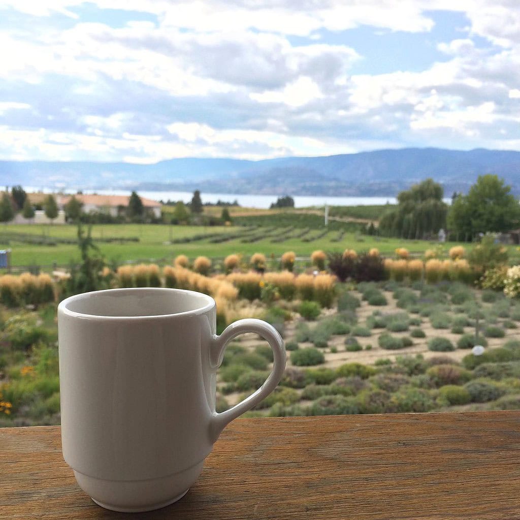
The Okanagan is famous for its wineries, but fruit growing came first. Thanks to the valley’s hot summers and long growing season, generations of orchardists helped make Kelowna one of Canada’s best-known fruit-growing regions. If you’re visiting in July or August, don’t rush past the roadside fruit stands—you’ll often find produce picked that very morning.
🧭 How to Visit These Highlights
Suggested itinerary
Morning at Kangaroo Creek Farm → fruit stop at Paynter’s Market → afternoon at Big White → The KF Centre for Excellence → finish with sunset from Knox Mountain Park.
- Best season: Late spring through early autumn for fruit stands and Kangaroo Creek; winter for skiing at Big White.
- Where to stay: Downtown Kelowna for easy access to restaurants and the waterfront, or Big White Resort if you’re planning several mountain activities.
- Good to know: Big White and Kangaroo Creek are both popular during school holidays, so book activities or arrive early where possible.
Episode 3: “We’re Here Baby We’re Trying to Win” -Kelowna → Jasper, AB
This week the race carries us from the Okanagan lakeshore up into the Rockies, and it’s one of my favourite kinds of routes. It’s the sort where the journey between the destinations is just as good as the stops themselves.
Teams began at the Kelowna waterfront, took part in a century-old rodeo in Falkland, then boarded one of the world’s most beautiful trains to travel through the Thompson Okanagan and into Alberta.
For a slow-travel lover like me, this is the dream: part of the leg was less about rushing and more about savouring everything in between…with a secret roadblock along the way.
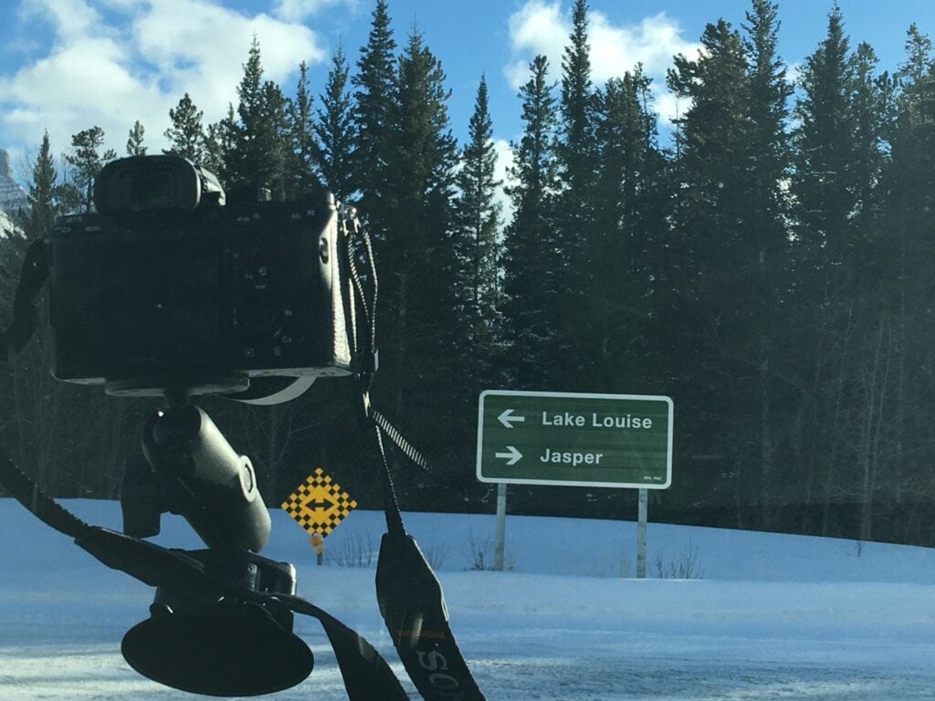
Follow the route: Kelowna Yacht Club → 🤠 Falkland Stampede Grounds → Kamloops → 🚂 Rocky Mountaineer to Jasper → Pine Bungalows → Old Fort Point → Morro Slabs → Maligne Lookout
📍 Falkland Stampede Grounds: Falkland, BC
5811 Highway 97, Falkland, BC V0E 1W1
The leg’s first challenge sent teams to the Falkland Stampede Grounds for a “Calf Scramble,” grabbing matching ribbons from a calf’s tail to earn the next clue.
Falkland is a tiny community on Highway 97 between Vernon and Kamloops, easy to drive straight through. But for one weekend a year, it hosts one of Canada’s oldest rodeos.
That said, the main event is a rodeo, which involves working animals in roping and riding events. Although I prefer not to include rodeo-style animal activities in my own plans, it’s a long-standing part of this community’s history, and I’ll leave it to you to decide whether it’s something you’d like to see.
What you can do there:
- Catch the stampede over the May long weekend (the 2027 dates are May 22–24)
- Watch the free Highway 97 parade on the Sunday
- Enjoy a pancake breakfast and the food and beverage vendors
- Visit the nearby Falkland Museum & Heritage Park
- Use it as a scenic stop on the drive between Kelowna and Kamloops
Local tip: If you’re driving through on parade day, note that Highway 97 closes for the duration — worth planning around if you’re just passing through.
- Website: thefalklandstampede.ca
- When: Annually over the May long weekend; gates 10:00 AM daily
- Getting there: On Hwy 97, roughly 45 minutes from both Vernon and Kamloops


📍 Kamloops: Thompson Okanagan, BC
Rocky Mountaineer station: 525 CN Road
From Falkland, the route continues to Kamloops, where teams boarded the Rocky Mountaineer. But Kamloops is very much worth slowing down for in its own right.
Sitting where the North and South Thompson Rivers meet, it’s a wonderful Thompson Okanagan destination that too many people speed past. It deserves better.
It’s an all-season base with a walkable riverfront. Add world-class mountain biking, lake days, and easy hiking, and it’s a place that rewards an extra night.
What you can do there:
- Stroll Riverside Park along the Thompson River
- Hit the renowned mountain biking and hiking trails
- Paddle or swim the nearby lakes
Local tip: Kamloops makes an ideal overnight between the Okanagan and the Rockies, so give yourself a full day to enjoy the wine trail and the river rather than treating it as a quick stopover.
- Region: Thompson Okanagan
- Best season: All-season, with wineries and trails at their best spring through fall
- Getting there: About 1.5 hours from Kelowna on Hwy 97/5
More Articles to Help You Plan Your Trip to Kamloops
- Is Kamloops Worth Visiting? Here’s My Honest Take
- 3 Days in Kamloops Itinerary: Nature, Culture, and Foodie Stops
- Things to Do in Kamloops Beyond the Outdoors: Art, Museums And Culture
- Things to Do in Kamloops at Night
- 21+ Cheap or Free Things to Do in Kamloops, BC
- DoubleTree by Hilton Kamloops Hotel Review: Downtown Stay
- Murals and Street Art in Kamloops: The Best Spots Downtown
- 10 Best Places for Vegan Food in Kamloops, BC + Map
- 17 Things to do in Kamloops in Fall Amongst the Autumn Leaves
- Drive From Vancouver to Kamloops: Routes and Road Trip Stops
- Things to Do Between Kamloops and Revelstoke: Best Stops
🚂 Riding the Rocky Mountaineer: Kamloops → Jasper
📍 Kamloops station: 525 CN Road, Kamloops, BC · Jasper station: 607 Connaught Drive, Jasper, AB
This, for me, is the heart of the whole episode. After Kamloops, teams boarded the Rocky Mountaineer into Jasper, with a “Travelling Roadblock” playing out onboard as they crossed into Alberta.
If there’s one experience here that captures what slow travel is all about, it’s this train. The “Journey through the Clouds” route runs between Vancouver and Jasper, passing through Kamloops.
Here’s the part I love: it travels entirely in daylight, so you don’t sleep through a single mountain. Instead of racing the scenery, you settle into a glass-domed coach and watch the landscape unfold at exactly the pace it deserves.
On the Kamloops-to-Jasper leg the racers took, you follow the North Thompson River through the Clearwater region. The rewards include a rail-only view of Pyramid Falls near Blue River and, on the approach to Jasper, Mount Robson – the highest peak in the Canadian Rockies.
What you can do there:
- Ride the full Vancouver–Jasper route, or a shorter Kamloops–Jasper leg
- Choose SilverLeaf or the elevated GoldLeaf service (bi-level glass-dome cars, gourmet meals)
- Watch for Pyramid Falls near Blue River and Mount Robson on the approach to Jasper
- Linger over meals and let the hosts’ storytelling set the pace
- Build it into a longer, unhurried Rockies itinerary
Local tip: The Rocky Mountaineer never travels overnight…that’s the whole point – so journeys include an overnight hotel stop in Kamloops. Lean into it as another chance to enjoy the Thompson Okanagan, and book well ahead as it’s seasonal and popular.
- Website: rockymountaineer.com
- Season: Roughly mid-April through October
- Getting there: Board at Kamloops (525 CN Road); arrive at Jasper station (607 Connaught Drive)
📍 Pine Bungalows: Jasper, AB
2 Cottonwood Creek Road
Once in Jasper, the racers headed to Pine Bungalows to pick up their next clue.
These riverside cabins sit on about 11 acres along the Athabasca River, roughly 2 km outside the Jasper townsite. It’s the kind of woodsy cabin base that suits an unhurried Jasper trip, tucked in the trees but still minutes from town.
What you can do there:
- Book a cabin as your Jasper home base
- Walk the riverside grounds along the Athabasca
- Enjoy a quieter alternative to staying right in town
Local tip: Jasper accommodation books up fast in summer, and even more so as the town rebuilds — reserve early if you’d like a cabin here.
- Website: pinebungalows.com
- Season: Typically spring through fall
- Getting there: About 2 km east of Jasper townsite off Highway 16
🌲 The Jasper Detour: Wildfire Recovery
📍 Jasper townsite & Jasper National Park, AB
This leg’s Detour had teams either planting trees or building garden boxes, both tied to Jasper’s recovery from the devastating 2024 wildfire.
I think it’s genuinely lovely that the show worked this in. The 2024 wildfire damaged a large part of the town and surrounding park, and Jasper has been steadily rebuilding ever since.
The most helpful thing visitors can do is simply show up and stay for a while. Staying, dining, and booking local experiences all put money directly back into a community that’s healing.
What you can do there:
- Check Parks Canada for the latest on open trails and areas
- Support local: stay, dine, and book tours in town
- Look for guided interpretive experiences that share the fire’s story
- Be patient and respectful – some areas are still recovering
Local tip: Before planning specific hikes, check the Parks Canada “what’s open” page for Jasper, since access changes through the recovery.
📍 Old Fort Point: Jasper, AB
Old Fort Point Road, off Highway 93A
Teams picked up a clue at Old Fort Point, one of Jasper’s most popular short hikes.
If you only have time for one quick leg-stretcher near town, this is the one I’d point people to. It’s a roughly 3.5–4 km loop with about 130 m of climbing, moderate with a steep bit near the start.
The reward is sweeping views over the Athabasca Valley, the Jasper townsite, and the surrounding peaks. It usually takes about an hour to an hour and a half, so it slots easily into a relaxed day.
What you can do there:
- Hike the summit loop for valley and townsite views
- Watch for wildlife and photograph the Athabasca River below
- Connect onward toward the Valley of the Five Lakes for more
Local tip: Go early morning or near sunset for the best light and fewer people.
- Distance: ~3.5–4 km loop, ~130 m elevation gain
- Difficulty: Moderate (short steep start)
- Getting there: ~3 km south of Jasper via Highway 93A, then Old Fort Point Road
📍 Morro Slabs: Jasper, AB
Highway 16, west of Jasper townsite (by the Athabasca River)
For the second Roadblock, one team member rappelled about 100 feet down the Morro Slabs before climbing back up.
Morro Slabs is a limestone wall right along the Athabasca River, just off Highway 16 west of town. It’s a well-known local climbing and rappelling spot.
The best part is that it’s beginner-friendly terrain, so you don’t need to be a hardcore climber to give it a try with a guide. Several Jasper outfitters run half-day rock-climbing tours here, typically from May through September.
What you can do there:
- Book a guided beginner rock-climbing or rappelling session
- Enjoy the riverside setting even as a scenic stop
- Combine it with the drive west toward Mount Robson
Local tip: No experience needed for the guided tours – gear and instruction are included, making it a fun “try something new” day.
- Season: Guided climbing roughly May–September
- Getting there: Along Highway 16 west of Jasper, by the Athabasca River

📍 Maligne Lookout: Jasper, AB (The Pit Stop)
Maligne Lake Road, Jasper National Park, AB
The leg wrapped at a lookout along Maligne Lake Road, where teams checked in with host Jon Montgomery.
The Maligne Valley is one of Jasper’s signature slow-travel drives, a winding 44 km road past Medicine Lake up to Maligne Lake, the largest natural lake in the Canadian Rockies. It’s the launching point for Spirit Island, one of the most photographed views in Canada, reachable by boat cruise.
Even the drive there, with its lookouts and wildlife, is worth taking your time over. Give yourself space to stop often.

What you can do there:
- Drive Maligne Lake Road, stopping at the lookouts and Medicine Lake
- Take a boat cruise to Spirit Island (a Jasper classic)
- Canoe or kayak on Maligne Lake
- Hike nearby trails like the Bald Hills or Opal Hills loops
Local tip: Maligne Canyon along the same road has been affected by recent closures during recovery, so check current access before planning your day around it.
- Getting there: Maligne Lake Road, off Highway 16 just east of Jasper
- Good to know: Give yourself the better part of a day to enjoy the whole valley
🧭 How to Visit These Highlights
Suggested slow-travel plan: Spend a night or two enjoying Kamloops → board the Rocky Mountaineer for the unhurried ride into Jasper → settle into a base like Pine Bungalows → savour your Jasper days on Old Fort Point, the Maligne Valley, and Morro Slabs.
- Best season: Late spring through early fall – the stampede is May, and Jasper’s hiking, climbing, and boat cruises are at their best in summer.
- Getting around: The Rocky Mountaineer is the scenic, savour-it centrepiece; driving the Yellowhead (Hwy 16) is the flexible alternative. Either way, you’ll want a car once you’re in Jasper.
- Where to stay: Kamloops is a destination in its own right, so give it a night; in Jasper, cabins like Pine Bungalows or in-town hotels, booked early as the town rebuilds.
- Good to know: Jasper is actively recovering from the 2024 wildfire, so check Parks Canada for current openings – and remember that simply visiting supports the community.
Episode 4: “Our Taxi Left Us” – Alberta → Québec
Follow the route: ✈️ Alberta → Montréal → Serres Cléroux, Laval → Montréal Museum of Fine Arts → Club Electric Avenue → Petros Griffintown or Musée Imaginarium → Peel Pub → Centre de la nature, Laval
📍 Serres Cléroux: Laval, Québec
1570 rue Principale, Laval, QC
After flying to Montréal, teams travelled to Serres Cléroux in Laval for the Intersection. Working in pairs, they searched the greenhouse and collected items needed for the next challenge.
Serres Cléroux is a large working greenhouse and garden centre with hundreds of plant varieties. Gardeners may enjoy browsing, but most travellers won’t need to make a special trip here.
Website: serrescleroux.com
Open: Year-round; plants and displays change seasonally
Getting there: In western Laval; easiest to reach by car
🌿 A Better Garden Stop: Montréal Botanical Garden
4101 rue Sherbrooke Est, Montréal, QC
If the greenhouse challenge inspires you to add a garden to your Montréal plans, visit the Montréal Botanical Garden instead.
Its exhibition greenhouses and themed outdoor spaces include the Chinese Garden, Japanese Garden and First Nations Garden. Allow two or three hours and focus on the collections that interest you most.
Website: espacepourlavie.ca
Open: Year-round, with seasonal outdoor gardens
Getting there: Near Pie-IX métro station
Good to know: The greenhouses make this a useful rainy-day or winter option.
📍 Montréal Museum of Fine Arts: Montréal, Québec
1380 Sherbrooke Street West
Teams found their next clue outside the Montréal Museum of Fine Arts. There wasn’t a challenge inside, but this is one race location worth adding to your Montréal plans.
The collection includes around 47,000 works, with six floors devoted to Québec and Canadian art alongside Indigenous, international, contemporary and decorative arts collections.
What you can do there:
- Focus on the Québec and Canadian galleries
- See the current temporary exhibitions
- Visit the Indigenous and Inuit art displays
- Walk through the surrounding Golden Square Mile
Local tip: Allow at least two hours and choose a few galleries rather than trying to cover every pavilion.
Website: Montréal Museum of Fine Arts
Getting there: Near Peel and Guy-Concordia métro stations
Open: Year-round; hours vary by day
🪩 Club Electric Avenue and Montréal’s Disco History
1476 Crescent Street
The paired teams continued to Club Electric Avenue for a disco-themed Intersection challenge. The current club plays music from the 1980s, 1990s and 2000s, but the challenge also points back to an important part of Montréal’s music history.
By the late 1970s, Billboard considered Montréal North America’s second-most important disco market. Clubs such as the Lime Light helped launch records and DJs, including Robert Ouimet, who became known as the Godfather of Montréal Disco.
Local tip: You don’t need to visit the club to follow the history. The former Lime Light stood at 1254 Stanley Street, a short walk from Crescent Street.
Website: Club Electric Avenue
Getting there: Near Peel métro station
Good to know: This is an evening nightlife venue rather than a daytime attraction.
The Detour: Petros or Musée Imaginarium
Teams chose between two Griffintown locations. Both belong in the route, although Musée Imaginarium offers more for travellers looking for an activity.
📍 Petros Griffintown: Montréal, Québec
1613 William Street
Petros provided the setting for the Greek-themed side of the Detour. It’s a Greek restaurant in Griffintown, close to the Lachine Canal and several of the neighbourhood’s converted industrial buildings.
The menu focuses heavily on seafood and grilled dishes, so vegan travellers should check the current options before planning a meal.
Website: Restaurant Petros
Neighbourhood: Griffintown
Getting there: About a 10-minute walk from Lucien-L’Allier métro station
📍 Musée Imaginarium: Montréal, Québec
290 rue de la Montagne
The other Detour option brought teams to Musée Imaginarium, where the attraction itself is much closer to what travellers can experience.
This creative photo space has 16 immersive sets, including a Montréal alley, tropical forest and poutine pool. Visitors have about an hour to create their own photographs and videos throughout the rooms.
What you can do there:
- Photograph the themed installations
- Create short videos and portraits
- See rooms designed by Montréal artists
- Browse locally made items in the shop
Local tip: Go with someone willing to swap photographer duties, and arrive with a fully charged phone or camera.
Website: Musée Imaginarium
Visit length: Approximately one hour
Getting there: In Griffintown, near the Lachine Canal
📍 Peel Pub: Downtown Montréal
1196 Peel Street
Teams stopped at Peel Pub for a Molson Canadian challenge before returning to Laval.
I don’t drink alcohol, so this wouldn’t be a priority stop for me. However, its downtown location makes it an easy place to take a break for food or a non-alcoholic drink between the museum, Crescent Street and the final drive to Laval.
Peel Pub has been part of downtown Montréal for more than 60 years and reopened under new ownership in March 2026 after a brief closure.
Website: Peel Pub Montréal
Getting there: Near Peel métro station
Good to know: It’s close to Dorchester Square and the Bell Centre.
📍 Centre de la nature: Laval, Québec
901 avenue du Parc
The leg ended at Centre de la nature, where teams met Jon Montgomery at the Pit Stop.
This 50-hectare urban park is the strongest reason in the episode to spend extra time in Laval. It has gardens, a lake and approximately five kilometres of walking paths, with different activities throughout the year.
What you can do there:
- Walk around the lake and gardens
- Follow the wooded paths
- Visit the seasonal flower displays
- Bring a picnic and slow down after a day downtown
- Return in winter for seasonal outdoor activities
Local tip: The park is large enough for a half-day visit, but the lake and gardens make an easy shorter walk if you’re fitting it around other Laval stops.
Open: Year-round
Getting there: Driving is easiest; paid parking is available
Accessibility: The park is listed as accessible for visitors with reduced mobility
FAQs About Visiting Montréal and Laval
Do I need to speak French in Montréal?
No. French is Québec’s official language, but English is commonly spoken at Montréal hotels, restaurants, museums and major visitor attractions.
Start with bonjour, and use merci and s’il vous plaît when you can. Signs and announcements may appear primarily in French, particularly once you travel outside central Montréal.
Is Laval worth visiting from Montréal?
Yes, particularly if you want gardens, parks and a break from downtown. Centre de la nature is the most worthwhile Episode 4 stop for travellers, while Montréal’s botanical garden is a better choice than making a special trip to Serres Cléroux.
Can I follow this route without a car?
Most Montréal stops are easy to reach by métro or on foot. A car is more practical for Serres Cléroux and Centre de la nature in Laval, so I’d group the Laval locations into a separate half-day trip.
Episode 5: “We Got the Beaver” – Québec → Ontario
Follow the route
✈️ Montréal → Toronto → 🚆 Oshawa → Peterborough → Rogers Cove Park → Canadian Canoe Museum → Rogers Cove Park or Lindsay Samuel Education Centre → Bobcaygeon → Buckhorn Lock 31
📍 Rogers Cove Park: Peterborough, Ontario
131 Maria Street
Teams started their Kawarthas leg at Rogers Cove Park with a series of cottage-style games before later returning to the water for a canoe challenge.
The waterfront park sits on Little Lake, with green space, a beach and trails that connect with nearby Beavermead Park.
What you can do there:
- Walk along Little Lake
- Bring a picnic or use the beach in summer
- Continue along the waterfront trails
Open: Year-round; some facilities are seasonal
Parking: Available on-site
📍 Canadian Canoe Museum: Peterborough, Ontario
2077 Ashburnham Drive
The Canadian Canoe Museum holds the world’s largest collection of paddled watercraft, using canoes and kayaks to share stories about Indigenous knowledge, craftsmanship, travel and Canadian history.
Its location on Little Lake also connects naturally with the paddling theme running throughout this episode.
What you can do there:
- See canoes and paddled watercraft from across Canada
- Learn about Indigenous canoe-building traditions
- Walk along the lakefront campus
Website: canoemuseum.ca
Open: Year-round
Getting there: On Little Lake in Peterborough
🐢 Lindsay Samuel Education Centre: Peterborough, Ontario
The other route option sent teams to the Ontario Turtle Conservation Centre’s Lindsay Samuel Education Centre.
I prefer not to include animal-related attractions in my own travel plans, but you may feel differently. The centre focuses on turtle rehabilitation, conservation and public education, so check its current visitor programs directly if you’d like to include it.
Website: ontarioturtle.ca

📍 Bobcaygeon, Ontario
Teams continued through cottage country to Bobcaygeon, delivering Kawartha Dairy ice cream and butter tarts around town before receiving their next clue.
The town’s name will already be familiar to many Canadians thanks to The Tragically Hip’s Bobcaygeon. It’s also right on the Trent-Severn Waterway, with Lock 32 in the centre of town and an easy-to-walk waterfront.
What you can do there:
- Walk around downtown Bobcaygeon
- Watch boats pass through Lock 32
- Stop at local shops and bakeries
🍦 Kawartha Dairy: Bobcaygeon, Ontario
89 Prince Street
Kawartha Dairy began in Bobcaygeon in 1937 and remains a family-owned Canadian company. Its original Bobcaygeon location includes the company’s production facility, head office and retail store.
As a vegan, the dairy isn’t somewhere I’d personally stop for ice cream, but its long connection to Bobcaygeon makes it worth mentioning as part of this route.
🥧 Butter Tarts in the Kawarthas
The racers also delivered butter tarts around Bobcaygeon, another food strongly associated with Ontario road trips.
Rather than trying to recreate the race route exactly, look for local bakeries as you travel through Peterborough and the Kawarthas. The region has even promoted a Butter Tart Tour connecting bakeries and cafés.
📍 Buckhorn Lock 31: Buckhorn, Ontario
The leg ended at Buckhorn Lock 31, part of the Trent-Severn Waterway National Historic Site.
The 386-kilometre Trent-Severn Waterway links Lake Ontario with Georgian Bay through lakes, rivers, canals and historic locks. Lock 31 makes an easy waterfront stop even if you aren’t travelling by boat.
What you can do there:
- Watch boats move through the lock
- Picnic beside the water
- Walk around Buckhorn
Website: Parks Canada – Trent-Severn Waterway
Open seasonally: Lock operations are seasonal
Facilities: Picnic area, washrooms and paddle dock
🧭 How to Visit These Highlights
This episode makes a surprisingly practical Peterborough and Kawarthas road trip.
Spend your first day around Peterborough, combining Rogers Cove with the Canadian Canoe Museum. Then drive north through cottage country to Bobcaygeon and Buckhorn, following the Trent-Severn Waterway through the communities featured in the race.
Best season: Late spring through early fall, especially for paddling and active lockstations.
Getting around: A car is the easiest way to follow the route once you leave Peterborough.
Episode 6: “We Like to Watch Romcoms Together”
Peterborough → Toronto Area
This leg stays within the Greater Toronto Area, with challenges in Scarborough and Markham rather than the kind of major visitor attractions featured in earlier episodes.
There are still a few locations you can visit if you want to follow the route yourself, including a public sports centre, Main Street Unionville and the striking R.C. Harris Water Treatment Plant.
Follow the route: Peterborough → Toronto Union Station → Toronto Pan Am Sports Centre or Casa Deluz Banquet Hall → Canadian Community Table Tennis Association, Markham → Main Street Unionville → R.C. Harris Water Treatment Plant, Scarborough
📍 Toronto Pan Am Sports Centre: Scarborough, Toronto
875 Morningside Avenue
One side of the Detour brought teams to the Toronto Pan Am Sports Centre for a synchronized swimming challenge.
Built for the 2015 Pan American and Parapan American Games, the facility is still an active public recreation centre with Olympic-size pools, fitness facilities and drop-in sports programs.
Website: tpasc.ca
Open: Year-round
Good to know: Check the current public and drop-in schedules before visiting.
🥟 Casa Deluz Banquet Hall: Scarborough, Toronto
1571 Sandhurst Circle
The other Detour option took teams to Casa Deluz Banquet Hall for a dim sum challenge.
This is primarily a Chinese restaurant and banquet hall rather than a sightseeing stop, but fans who want to recreate the route can visit for a meal.
Location: Woodside Square, Scarborough
Good to know: Check current opening hours before going.
🏓 Canadian Community Table Tennis Association: Markham
1181 Denison Street
Teams faced each other in a table tennis Face Off at the Canadian Community Table Tennis Association.
The Markham club is open to players and has dozens of competition tables, coaching and regular programs, so this is one challenge location you can actually experience for yourself.
Website: en.cctta.net
Open: Daily
Good to know: Contact the club or check current drop-in options before visiting.
🎬 Main Street Unionville: Markham
Teams next headed to the gazebo on Main Street Unionville for a challenge connected to holiday romantic movies.
This is the most useful travel stop in the episode. Historic Main Street Unionville has shops, restaurants, heritage buildings and the Millennium Bandstand, with concerts and community events held throughout the year.
It has also been used as a filming location, which makes the movie-themed challenge especially fitting.
What you can do there:
- Walk along historic Main Street
- Stop at independent shops and restaurants
- Check for concerts and events at the bandstand
Website: unionville.ca
📍 R.C. Harris Water Treatment Plant: Scarborough, Toronto
2701 Queen Street East
The leg ended at the R.C. Harris Water Treatment Plant, where teams met Jon Montgomery and Olympic sprinter Andre De Grasse.
The Art Deco water treatment plant is one of Toronto’s most distinctive civic buildings and has appeared in numerous film and television productions.
It remains an operating facility, so you cannot normally tour the interior. Public access is occasionally offered during Doors Open Toronto, while the exterior and nearby waterfront can still be viewed year-round.
Good to know: Public vehicles cannot enter or park at the plant. Walk, bike or use transit if you want to see the exterior.
🧭 Following the Episode 6 Route
Unlike the Peterborough and Kawarthas leg, I wouldn’t build an entire Toronto trip around these locations.
If you already live in or are visiting the Toronto area, Main Street Unionville is the strongest standalone stop. The Toronto Pan Am Sports Centre and table tennis club are useful if you want to try the activities featured on the show, while the R.C. Harris Water Treatment Plant is worth seeing for its architecture and filming history.
FAQs About The Amazing Race Canada Season 12 Locations
Where did The Amazing Race Canada Season 12 start?
Season 12 started atop Whistler Mountain in Whistler, British Columbia.
What was the first location in The Amazing Race Canada Season 12?
The starting line was Whistler Mountain (part of Whistler Blackcomb). From there, Leg 1 ran through Whistler Village, the Whistler Sailing Club on Alta Lake, and Squamish Canyon, before finishing at the Capilano University Squamish campus.
Where the Race Begins
Whistler is a strong start for Season 12 because it gives the show immediate mountain drama, but it also gives travellers a real place to build a trip around.
You can use the episode as a spark, then slow the whole thing down.
Ride the gondola. Walk the village. Add a cultural stop. Sit by a lake. Have a snack. Radical stuff, apparently.
The racers have to move fast. You don’t.
Plan Your Canadian Adventure
A few trusted resources I use and recommend:
- Booking.com (Hotels + Stays) – Find places to stay across Canada
Compare hotels, hostels, and vacation rentals using a handy map tool. - Discover Cars (Rental Vehicles) – Search Canadian car rentals
Easily compare prices from major rental companies for your road trip. - Busbud (Intercity Buses) – Book Canadian bus routes
Affordable bus travel between cities and small towns across Canada. - Viator (Tours & Activities) – Browse tours across Canada
From guided walks to scenic day trips, find local experiences worth booking. - Airalo (eSIM Cards) – Get a Canadian travel eSIM
Stay connected while you explore without needing a physical SIM card. - Safety Wing (Travel Insurance) – Explore travel insurance options
If you're visiting Canada from abroad, travel insurance is worth looking into. This platform helps you compare plans. (Not financial advice.)
